

The New Zealand Walks for Wimps series provides essential information about short, relatively easy hikes around New Zealand. Today’s walk is Key Summit and Earland Falls, a day walk on the Routeburn Track. Click on the map markers at the bottom of this post for more great easy NZ walks!


Want a nice day hike? How about panoramic views of jagged mountain peaks and surrounding valleys, mirror-like tarns (lakes), stunning beech forests, high alpine vegetation, and a 174m high waterfall? Sound ok? Yeah, I thought so. So try this one!

For orientation’s sake, the Routeburn Track goes all the way from The Divide across some mountains to its other end, just outside Glenorchy. The whole track normally takes 3-4 days to complete. The Key Summit track is a side trail off the main Routeburn Track between The Divide and Lake Howden Hut.

This hike has a few options. All start at The Divide carpark on the Te Anau – Milford Sound road, about 83km from Te Anau. (Note that there are other day walks accessible from the other end of the Routeburn Track just outside of Glenorchy.)

The return hike to Key Summit is about 3 hours, of course more if you stop for lunch at the top, which I highly recommend. And there’s a loop nature trail at the top that is entirely worth it for the views and the learning!


If you just want to go to Earland Falls it’s 12km return and while there are a couple of steep uphill stretches, it’s mostly fairly mild. It should take you about 4-5 hours, and you can stop at Lake Howden Hut after an hour and a half for a pretty view and a bathroom break!

If you only want to go to Lake Howden and back it’s also 3 hours return, or you could combine it with Key Summit for a 4-5 hour hike.
Confused yet? Yeah, me too. Check out the map at the top to help make it all clear.
So I know I said you could just go to Lake Howden Hut or just to Earland Falls, but it would really be a shame to come here and not get up to Key Summit! You’d be missing the best part!

And come on, a 6-7 hour day including lunch is totally doable! My friend and I didn’t even get started until around noon after driving up from Te Anau and finding and setting up the perfect campsite. We finished around maybe 6:30-7ish, although I think she probably could have gone a lot faster without slow old me.

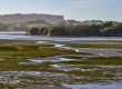
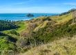
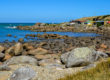
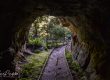
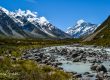
So there you have it. I could get all poetic about the majesty of the mountains and the exquisiteness of the lakes and the views, but haven’t the photos done that for me already? Go, and enjoy!

Have you hiked any of the Routeburn Track? Which stops did you make? Tell me about it in the comments!
Are you looking for another easy walk in this area? Head over to Wanaka to find the Diamond Lake and Rocky Mountain Track, or a little past there for the Rob Roy Glacier Track.
If you enjoyed this post, why not pin it?


Going in March! Finally have a walking buddy who wants to do these multi-day hikes, and we’ve booked Milford and this one, to do over 8 or 9 days. We’ll finish Milford and start Routeburn on the same day, so will get to Key Summit late in the day, hopefully for a nice sunset. As the next day is a fairly short one, dependent on weather might backtrack from Howden Hut and try to catch the sunrise from Key Summit as well, before heading out for the day. Looking so forward to this – but heaps of training to do in the meantime! Again, lovely photos.
That sounds both lovely and exhausting! Good on you for finding a buddy who wants to do them too. That’s always the challenge for me!
Thanks for the write up. This is such a stunning area…
Youre photos are amazing! The little map at the top is very helpful as well.
Thanks Julie! I’m glad you like the map. It took me ages to make those!